
Open
Season: all year
Days/Hours: sunrise-sunset
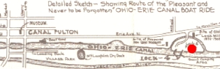
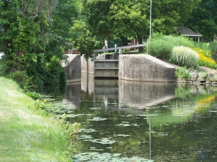
The "Fulton Lock"
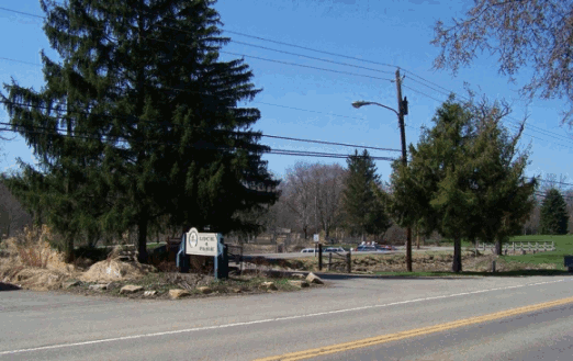
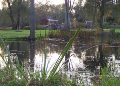
Located about 20 miles south of Akron's Summit Lake, Lock 4 Park stands as one of the best examples of a lift lock on the Ohio & Erie Canal.1 Canal engineers numbered this the fourth lock south of the Akron summit (not to be confused with lock 4 north - which is just under Bowery Street in downtown Akron).2 Locals and canal boatmen referred to it as the "Fulton Lock."3 The original sandstone structure was completed in 1827 and was one of 146 lift locks that allowed boats to navigate along the more than 1,000 feet of vertical relief from Lake Erie to the Ohio River.4 This specific lock had about a 7 foot lift. Though the lock is not currently operational, the park itself has been a local picnic grounds and favored fishing hole since the 1800's.
The Grist Mill
Like many other locks, Lock 4 facilitated not only commerce and transportation but also industry. Ingenuative and entrepreneurial people have long used natural forces like wind and water as energy sources to drive machinery. The constant flow of water around this elevation change afforded millers enough hydraulic power to drive mill stones. In the 1830's, James Duncan built a 4 story gristmill on the site. Duncan had even laid out plans to create a city around his mill (the town was to be called Fenelon),5 however, the competition with Fulton (which was a mere mile away) caused such aspirations to be abandoned.6 The mill, last operated about 1902, was razed in 1908.7 Two of its mill stones can be seen near the upper lock gates.
Restoring a Piece of Our Past
Toward the end of the 19th century, (what would later
prove to be the tail-end of the canal era) Ohio legislators
were reviewing plans to refurbish the much dilapidated
canal system. However, it would not be until the
early 1900's that such repairs would actually be
preformed. Among the improvements to be made were on
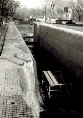
the original cut-sandstone walls. Lock 4 was
refurbished in 1908 by Dailey Brothers Construction
Company. The sandstone blocks of the lock chamber
were cut back and re-lined with cement. Though the
canal era would end within a decade of these repair
efforts, the walls themselves (having undergone
various repairs) have withstood. If
one looks closely, you can still see most of the
"Dailey Bros" stamp on the lock wall.8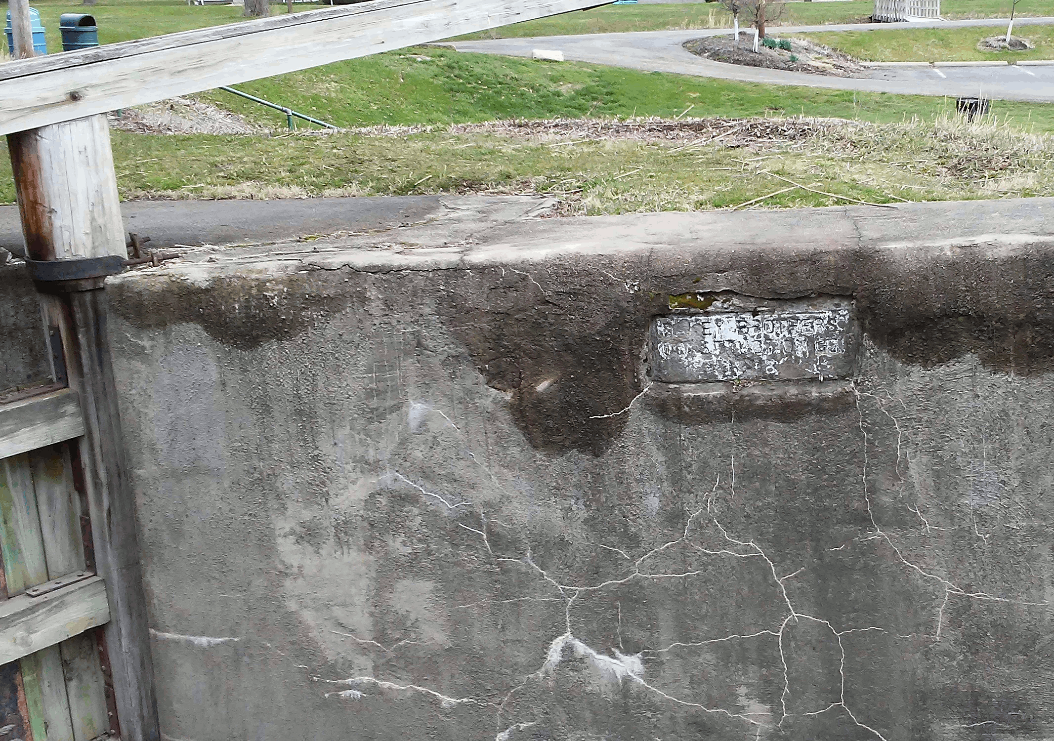
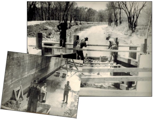
The lock gates have been replaced several times since the close of the canal era. In 1938, the Works Progress Administration made strides to transform portions of the canal corridor (specifically the Nimisila Feeder to about Massillon) into a long contiguous park.9 With the assistance of William McLaughlin, they had by the following year repaired the canal feeder and lock; repaired, watered and stocked the canal with fish and even built a small interpretive building next to the lock as headquarters for the park superindent. The little red-brick building depicts what a lock tenders' house might have looked like.10 World War II would apparently interrupt work on this strip of canal park, and in the post-war years the notion of such a park running the length of the canal was lost for sometime (though proponents would later suggest pockets of parks within this same corridor11 and eventually these canal lands would fall within the federally designated National Heritage Area of the Ohio & Erie Canal Corridor). All-the-same, the efforts at Lock 4 have stood through time and visitors today can continue to enjoy the fruits of all these labors.
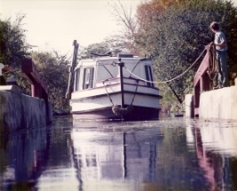
In 1970, Lock 4 would again see renewed interest as strides were made to make it functional once more. Indeed, the "splash down" of the St. Helena II sent out ripples in every direction (literally and ideologically). As the community now had a working canal boat, it only made sense to include a functioning lock in these operations. Grant money, donations and lots of sweat went into this restoration. In 1982, with a cadre of dignitaries present, the Heritage Society dedicated the grand re-opening of the lock with an inaugural boat ride and ceremony.12 Making their way south through this historic chamber, then turning around in the lower basin and locking through once more for the return trip to downtown, St. Helena II passengers throughout the next several years could genuinely enjoy the whole canal experience.
Lock 4 Today
While the lock and canal lands themselves remain the
property of the Stark County Commissioners, portions
of property between the canal and Erie Street were
gifted to the Stark County Historical Society for the
express purpose of historical enjoyment and recreation.13
In 1980, (in keeping with the rest of the Stark County Historical
Society's boat assets) these were also transfered to our
 Canal Fulton Heritage Society and we are proud to report
that these lands have continued to hold to these
original purposes.14
Whether for recreational fishing,
picnics or just as a place to park along the Towpath
Trail, Stark Parks does a wonderful job maintaining
this site for visitors.
Canal Fulton Heritage Society and we are proud to report
that these lands have continued to hold to these
original purposes.14
Whether for recreational fishing,
picnics or just as a place to park along the Towpath
Trail, Stark Parks does a wonderful job maintaining
this site for visitors.
The last time the lock was operational was the mid-1980's, yet even today many an area resident can recall the day they as a school child "locked through" this historic structure. Unfortunately, a combination of factors currently prevent the lock from operating. * While mention has been made toward re-restoring it, only time will tell if the St. Helena III herself may yet take passengers to the lower basin sometime in our near future!
Web Page Notes
1. While some locks are still plainly or at least partially visible as one explores along the Towpath within the Ohio & Erie Canal National Heritage Area or even in locales further south throughout the state, few locks are kept watered.
Our lock 4 ["Fulton Lock"] is second only to lock 38 [at "Hell's Half-acres"] - site of the current Canal Exploration Center operated by the National Park Service.
National Park Service, Cuyahoga Valley National Park. https://www.nps.gov/cuva/learn/historyculture/canal-exploration-center.htm (last accessed December 6, 2018).
2. While canal locks each had a number, this numerical system was confusing; thus were locks refered to by the collective names that boatmen gave them.
Terry K. Woods, The Ohio & Erie Canal: A Glossary of Terms, Second Edition Revised and Expanded, (Kent, OH: The Kent State University Press, 2011), 32.
3. Boatmen called it "Fulton Lock" no doubt for its vacinity to the town.
4. 1,207.35 feet to be exact.
Woods, Glossary, 4.
Frank A. Fisher, "Old Lock Mill," loose leaf article by former owner of premises, CFHS collections.
6. Duncan founded Massillon in 1826 and through the 1820's had established a number of milling businesses there.
Ruth Kane, Wheat, Glass, Stone and Steel: The Story of Massillon, (Massillon, Ohio: The Massillon Bicentennial-Sesquicentennial Committee, 1976), 27ff.
The industrious and forward thinking Duncan, who had wheedled both the Ohio & Erie Canal as well as the State Road into coming through his lands, was no doubt looking to continue expanding his influence in the area.
Fisher, "Lock Mill."
8.
"Dailey Brothers Construction Co 1908" was stamped
into the newly concreted lock wall; though,
a century worth of weathering
has made it increasingly more difficult to read
over the years.
Photo of eastern side of lower wing wall, 12 April 2018, taken by Website Editor.
"Old Ohio Canal Ready for Use as State park: Dedication of $303,627 WPA Project North of Massillon to be This Month," Canton Repository, 3 September 1939.
Tery Woods, "Canal Comments 18", 2012, CFHS collections.
10. The bricks themselves being re-purposed, came from old Route 21 - what is now Canal/Erie Street.
Carroll M. Gantz, Building the St. Helena II: Rebirth of a Ninteenth-Century Canal Boat (Kent, Ohio: Kent State University Press, 2012), 40.
Tery Woods, "Canal Comments 18", 2012, CFHS collections.
11. The preservation efforts of the 1960's would renew the interest in developing the canalway into a park system.
"The Stark Metropolitan Park Dustruct Story" The Canawler, 1968, Vol.1, No.3.
12. "As we approached the lock, I was expecting a bellowed, 'HEADWAY' from the young captain, a sign that his craft had sufficient momentum to reach and enter the lock, and a signal for the bowman to unhook the towline..." recounted Terry Woods, continuing on with a description of the dedication event and inaugraual locking through. "The descent is surprisingly smooth, with very little tendency for the boat to wallow in the rapidly shifting currents; a tribute to the efforts of the young crew. The opening of the lower gates of a lock have been described by one fanciful writer as being like 'the curtains of a stage opening on a new and imposing scenic vista.' He wasn't far from wrong."
Terry Woods, "Working Lock on Ohio & Erie Dedicated," American Canal Society, American Canals, November 1982, Bulletin # 43.
13. Mrs. George P. Mulhauser gifted $20,000 to the purchase of the several acres between the lock and Erie Street.
"1968 Canal Developments," The Canawler, 1968, Vol.1, No.3.
14. The land deed was clear to specify that "The property described above shall be maintained and used for historic site purposes only" and indeed at one point there was thought of building a museum on the premisis.
Warranty Deed, The Stark County Historicla Society Inc. to Canal Fulton Heritage Society, 18 December 1980, CFHS records.
"1968 Canal Developments," The Canawler.